The TIGER package contains a suite of programs for creating maps from Census Bureau data. Several programs and scripts extract, reformat, and optimize the data for display by the tgrmap.icn program.
The TIGER package is distributed in the Icon program library as the
directory gpacks/tiger.
The latest version of the package can be found at
http://www.cs.arizona.edu/icon/oddsends/tiger/src.
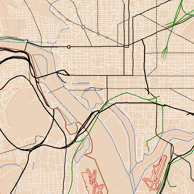
The files below are ready for use with tgrmap.icn. Some show small towns or center cities, while others encompass large metropolitan areas. The image above is a tiny portion of the huge Baltimore-Washington file. If you'd like to try something small, start with Manhattan or San Francisco.
| 27K | ames.zip | Ames, Iowa |
| 278K | austin.zip | Austin, Texas |
| 2280K | baltwash.zip | Baltimore / Washington |
| 459K | boston.zip | Boston, Massachusetts |
| 671K | chicago.zip | Chicago, Illinois |
| 151K | madison.zip | Madison, Wisconsin |
| 36K | manhattn.zip | Manhattan, New York City |
| 34K | mtkisco.zip | Mount Kisco, New York |
| 180K | oakland.zip | Oakland, California |
| 105K | orleans.zip | New Orleans, Louisiana |
| 513K | phoenix.zip | Phoenix, Arizona |
| 564K | pittsbgh.zip | Pittsburgh, Pennsylvania |
| 857K | portland.zip | Portland, Oregon |
| 17K | princetn.zip | Princeton, New Jersey |
| 518K | sandiego.zip | San Diego, California |
| 95K | sanfran.zip | San Francisco, California |
| 618K | sanjose.zip | San Jose, California |
| 536K | seattle.zip | Seattle, Washington |
| 410K | tucson.zip | Tucson, Arizona |
| 16K | twoharbs.zip | Two Harbors, Minnesota |
| 26K | wabasha.zip | Wabasha, Minnesota |
| 27K | westbend.zip | West Bend, Wisconsin |
| 147K | whidbey.zip | Whidbey Island, Washington |
To use one of these ZIP files, download it and unzip it to create a
file with a .llk extension.
(On Unix, unpack using gzcat, unzip, or
jar.)
Compile and execute tgrmap.icn, passing the file name as a command-line parameter. You can use the mouse to sweep out an area of interest for zooming, and you can save a zoomed map or create a PostScript file for printing. Further documentation is contained in the source code.
The data above was published by the Census Bureau in 1998. Several newer datasets are now available through the TIGER website. To convert raw TIGER data into a file suitable for input to the tgrmap.icn program:
*.RT1 and
*.RT2) to make a .lch file.
tgrmap.icn takes the resulting
.lch file as input.
You may use tgrlink.icn to optimize the
.lch file.
The above sample files were all optimized in this way.
By convention, we use the .llk extension for optimized
.lch files.
Old versions of tgrprep.icn (prior to
July, 2000) produced .lch files without feature names.
tgrmap.icn can display these files but
will not be able to identify features or find them by name.
GPS tracks can be converted to .lch files using
tgrtrack.icn and then displayed along
with map data.
The U.S. Geological Survey (www.usgs.gov) publishes similar maps in Digital Line Graph (DLG) form. That data is typically more accurate but the coverage is not as complete and feature names are omitted. The Icon program dlgvu may be used to view DLG data files.